Plan A
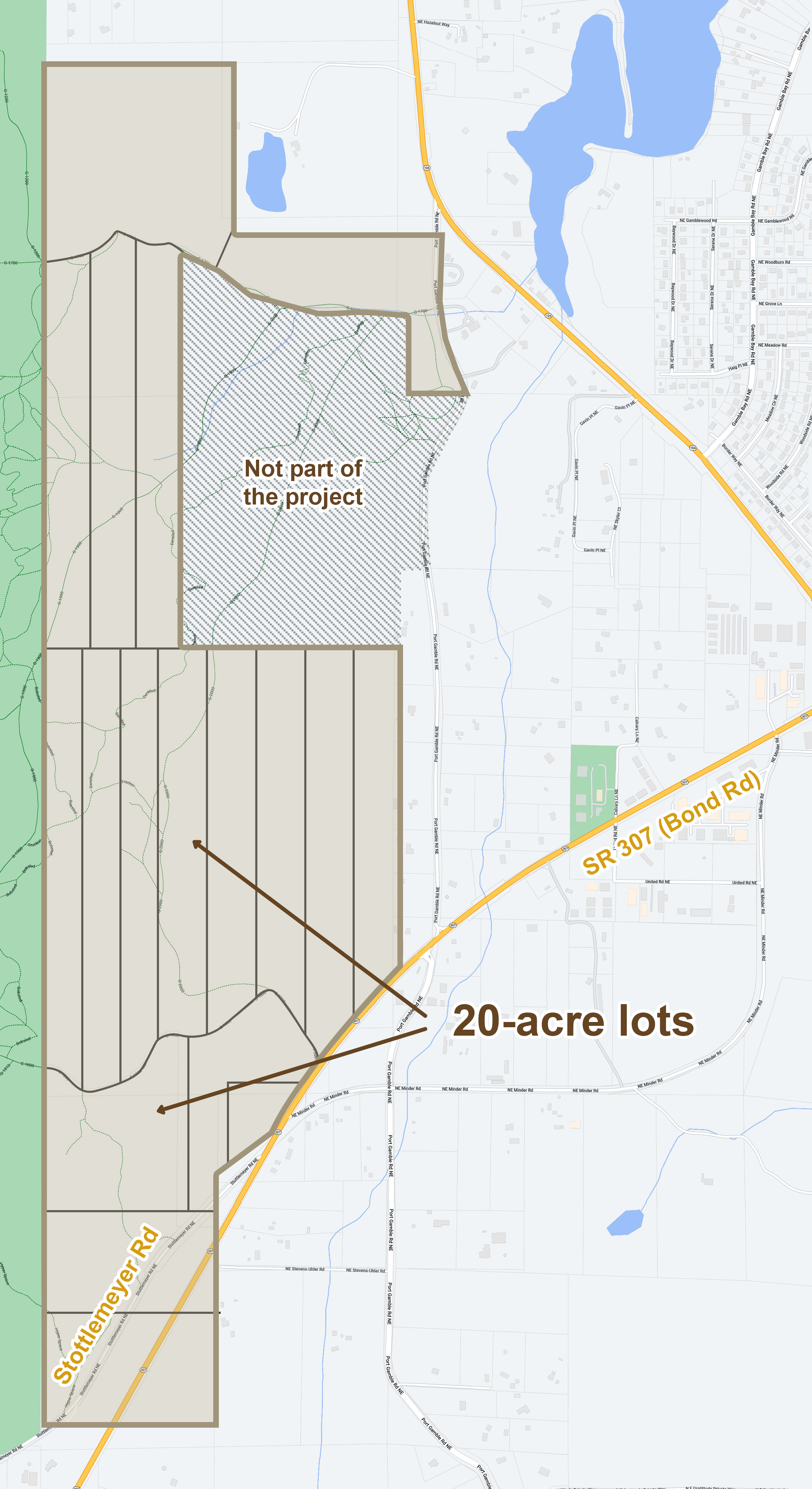
Unless a new plan is created, Raydient’s intention is to:
- Complete the harvest of mature trees
- Improve two of the existing logging roads with gravel surfacing and power for residential use
- Close the property to public access including the existing trails on the property (Derailed, Camel Back, Hyperspace, and Dirt Devil)
- Market and sell the existing 20-acre lots to individuals, families, or a single investor or company

Plan B
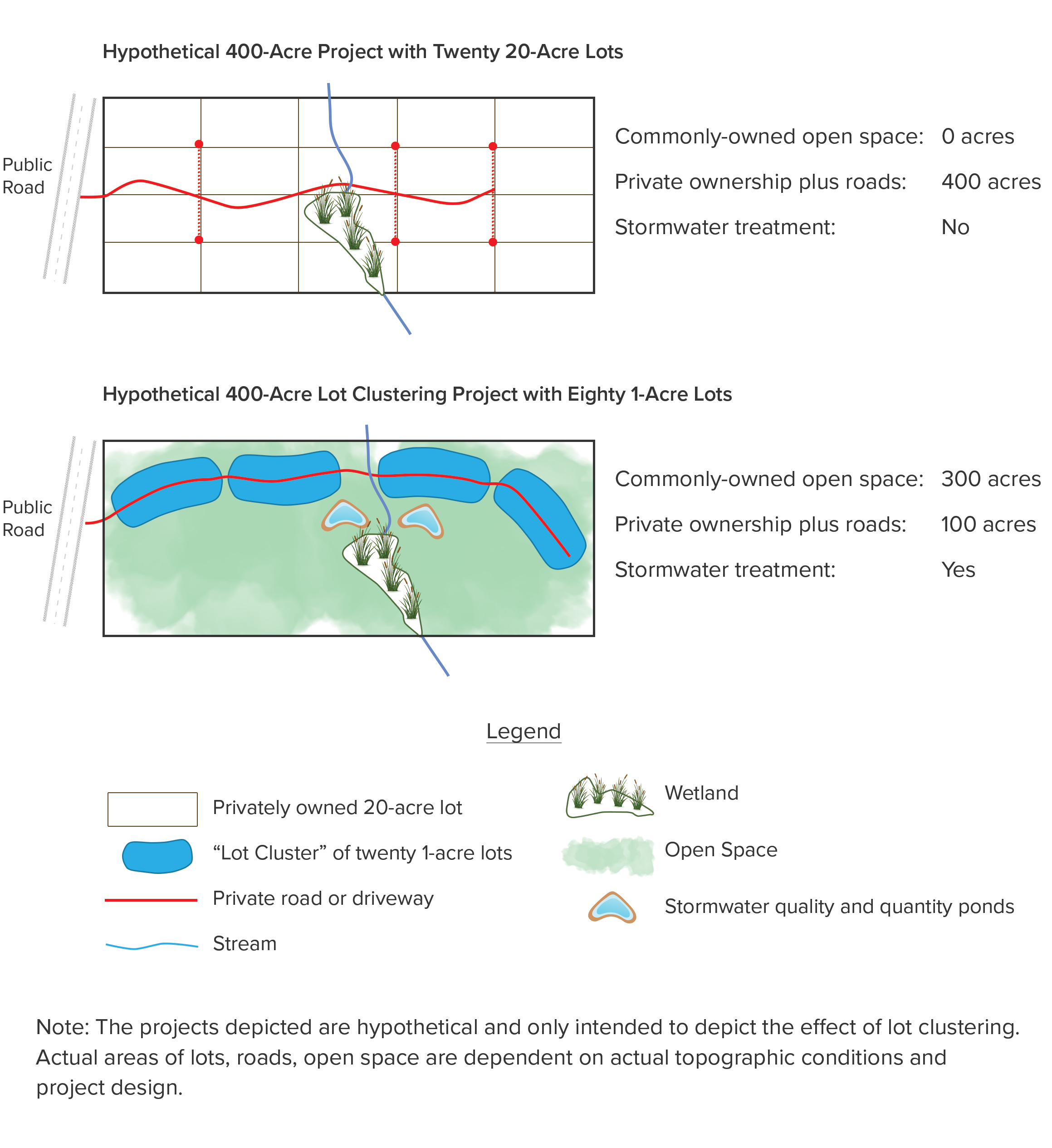
The NKU concept relies on a land planning concept known as “lot clustering.” Simply put, it reduces lot size from their maximum allowable size to a smaller, but still desirable scale.
In this case, Raydient’s requested zoning is for Rural Residential, allowing one dwelling unit per 5 acres. Rather than make all of the lots 5 acres, we will explore utilizing one-acre to two-acre lots. Roads, storm ponds, and other infrastructure typically take up an area equal to 20% of the residential area.
The examples to the right are idealized, but fully illustrate the concept and the possibilities for NKU and the community.
